1. IntroductionSince its reform and opening, China’s comprehensive national strength has increased significantly, and its development drew attention worldwide [
1,
2,
3]. However, following the vigorous urban construction demand of the rapid economic development [
4,
5,
6], the urban space within the city continues to expand [
7,
8,
9], the agricultural and ecological space are constantly compressed [
10,
11], and the ratio of the three spatial structures gradually tends to be unbalanced [
2,
12,
13,
14,
15,
16]. This phenomenon directly leads to the deterioration of the ecological environment and the waste of resources among other problems, thereby intensifying the contradiction between economic development, resources, and environment, and posing a serious threat to the sustainable development of national land space. In 2020, the Fifth Plenary Session of the 19th Central Committee of the Communist Party of China proposed that in the new development period, we should rapidly optimize the layout of national land and space, build a “new pattern of development and protection of national space” and a “national space layout and support system for high-quality development” [
17,
18,
19,
20,
21]. Therefore, the scientific and accurate optimization of the layout of territorial space is one of the major and urgent concerns in regional development [
2,
7,
17,
22,
23,
24,
25,
26,
27,
28]. To optimize the land space layout, we need to solve the problem of land-use layout optimization first. Most of the land resource optimization allocation models used by domestic and foreign scholars in the early stage are limited to the optimization of the quantitative structure of land use. The MOP (Multi-Objective Programming) model was used to optimize the quantitative structure of land resources, and then considered the quantitative optimization result as the constraint condition of Cellular Automata (CA) simulation to optimize the spatial layout [
25,
29,
30,
31,
32]. The effective unification of the optimization of land resources quantity structure and spatial layout was realized. In recent years, numerous local and international scholars have used other models to optimize land-use quantity and layout. The future land-use demand was estimated through grey prediction and an objective optimization model, and realized land-use layout optimization based on the CLUE-S model [
20,
33]. A land-use pattern optimization model was established by combining multi-agent (MA) and particle swarm optimization (PSO) [
34,
35]. And the compound optimization of land-use structure and layout at the county level was proposed by integrating the MOP and FLUS model [
35,
36,
37].Studies have shown that the optimization scheme combined with MOP and Land-Use Simulation model is superior to the single-model optimization scheme. In addition, the Future Land-Use Simulation (FLUS) model was developed based on the traditional cellular automata model [
8]. The simulation accuracy is higher than that of CLUE-S and ANN-CA [
38]. However, while solving the multi-objective optimization model of land use, most scholars at this stage adopt the subjective weighting method to determine the weight of the sub-objective function in the overall system, and the optimization results obtained cannot be guaranteed to be scientific [
35,
39,
40,
41]. In addition, most scholars only focus on optimizing the allocation mode of land-use resources at the present stage. In the new period of national promotion of “integration of multiple plans” and construction of territorial space planning system, exploring the layout optimization method from the perspective of spatial integrity is of significant practical value [
40,
42].
The optimal allocation of land resources is a complex, multi-level, and multi-objective system engineering, which requires continuous fitting and decision-making. The optimization content mainly includes two aspects, one being the allocation model that optimizes the macroscopic land-use quantity structure, and the other being the allocation model that optimizes the microscopic land-use spatial pattern, to improve the sustainable utilization rate of land resources and maintain the relative balance of the land environment and ecosystem. However, in most developing countries, following the acceleration of urbanization, the land-use structure that puts economic growth in the first place will damage the environmental ecological function of land resources. In certain rapidly developing areas, the government often resorted to administrative measures to interfere with the allocation of land resources and thereby protect the ecological and environmental resources of the region. In view of this, many scholars have studied the optimization of land resource allocation. Certain scholars combined the linear programming model as a tool of geospatial modeling with GIS, and considered the lowest rural unemployment rate as the objective function to study the Mediterranean coastal areas of Spain, to optimize land use. However, the linear programming model addresses nonlinear problems and the interaction between land-use types; therefore, it is not applicable for complex optimization problems of land use. In addition to the weights for each target given, it tends to join the planners of subjective judgment and reduce the optimization. In this case, the heuristic algorithm was integrated into optimization of land use, such as the simulated annealing, genetic, ant colony, and particle swarm optimization algorithms. The genetic algorithm has drawn considerable attention and has been used extensively. Presently, the optimal allocation of land resources mainly focuses on the optimization of land-use structure or spatial pattern, and research studies on the combination of the two are relatively limited. Despite the related research conducted, practical and effective technical methods are lacking.
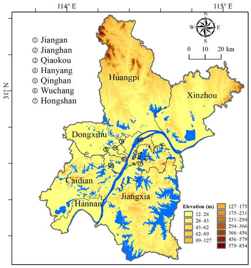
Therefore, this study introduced the improved non-inferior hierarchical genetic algorithm (NSGA II) in the process of solving the MOP model of land use, which effectively avoided the subjectivity caused by the traditional weighting method to deal with the multi-objective optimization function and yielded more scientific and accurate optimization results [
2,
43]. At the same time, based on the number of optimization of land use, the FLUS model was applied to implement the layout optimization of land use, and try to “three types of” technical code for space and based on “three” classification standards for the investigation of cohesion, in Wuhan city, Hubei province as the research object, analyzing scales in Xiamen city: urban space, agricultural space, and ecological space layout optimization methods. This study aimed to provide a scientific method for urban land space planning in the new period, and further develop the concept of ecological civilization construction and sustainable development. 3. Results 3.1. Land Use of Multi-Objective OptimizationNSGA II was used to establish the quantitative optimization model constructed above. Studies have shown that the genetic algorithm is random and the results of each run are different. However, the rule of one test is consistent with that of multiple tests [
19]. After several experiments, the population size of the algorithm in this study was set to 40. Crossover probability was set to 0.8, mutation probability to 0.1, constraint tolerance to 0.001, and the number of iterations to 1000.In this study, based on the 67 Pareto optimal solutions obtained by NSGA II, three solutions with the largest sum of economic benefits, the largest sum of ecological benefits, and the largest total comprehensive ecological and economic benefits were selected as the results of quantitative optimization (
Figure 2 and
Table 4). The results of land-use quantity optimization in Wuhan City under economic priority, ecological priority, and comprehensive consideration of economic and ecological benefits are presented, respectively. In addition, the simulation results of the spatial layout were obtained based on the FLUS model. Finally, according to the three types of spatial classification system constructed, the land-use optimization results were transformed into three types of spatial optimization results, and the land space layout optimization method of Wuhan was obtained. 3.2. Quantitative Structure Optimization
The reduction in the requirement for permanent prime farmland protection was transferred to the other two types of space. Among them, under the ecological benefit priority scenario, the agricultural space area decreased by approximately 54.4%, and the optimized area only accounted for 29.19% of Wuhan’s land area, which indicated that the contribution of cultivated land, garden land, and rural construction land to the urban ecological service value was low.
Under the ecological protection priority scenario, the ecological space area of Wuhan increased by 1002.43 km2, and the area proportion reached the maximum of the three scenarios. Particularly, the area of forest land increased significantly, and the area of wetland and water area increased slightly. Under the other two scenarios, the area of ecological space increased, reflecting the city’s requirements for strengthening mountain vegetation restoration and other related ecological restoration construction, and providing development space for Wuhan to establish a national demonstration city of ecological civilization construction.
During the new development of Wuhan into a national central city and a core city in the Yangtze River Economic Belt, its economy will continue to grow rapidly, and the demand for urban construction land will not be reduced. Under the three development scenarios, the area of urban space exhibited a relatively large increase. In the scenario of optimal comprehensive benefit and priority of economic benefit, the urban space increased by 54.67%, while in the scenario of ecological priority, owing to the strict protection of ecological land and emphasis on ecological service value in the system area, the area increase of urban space was lower than that of the other two cases, only increasing by 359.74 km2.
3.3. Spatial Layout Simulation
The FLUS model was used to analyze the Wuhan national spatial layout optimization; in the economic benefit of priority situation, for the agricultural space, the central city almost no longer had arable land, and reduced and the Huangpi District in the south of the Jiangxia District’s northwest area had more. While most agricultural space transformed into ecological space, there was also a part of the agricultural space which transformed into urban space. Under the scenario of optimal comprehensive benefits, the ecological space in the southwest and northwest areas of Wuhan was partially transformed into agricultural space, which provides favorable conditions for large-scale agricultural management. Under the ecological benefit priority scenario, part of the agricultural space in the northeast of Wuhan was transformed into ecological space, and part of the cultivated land patches had to be divided, resulting in a large degree of landscape fragmentation.
In addition, the ecological space of Wuhan in the base year was dominated by Huangpi District in the northwest, followed by the east side of Jiangxia District, where a large amount of woodland and grassland grew. In 2025, after the ecological benefit as the first optimization simulation, ecological space expansion of the large area, Jiangxia District, Wuhan was the most significant, while Caidian District and Xinzhou District’s ecological space areas also increased obviously, and even more for the transformation of the agricultural space. Mainly in the three areas, to drive the sustainable development of Wuhan city’s ecological protection, we should realize the farmland’s restoration into forest to implement the requirements of vegetation restoration. However, under the scenario of comprehensive benefits, the area change of the southeast area of Wuhan was relatively obvious. This area is mainly covered by Jiangxia District of Wuhan, including Liangzi Lake area. Agricultural space is obviously transformed into ecological space, and Liangzi Lake was the core area for expansion.
As shown in
Figure 3, the urban space mainly expanded from the central urban area to the surrounding areas in the “spreading the pie” manner, and in the process, mainly encroached on agricultural space such as farmland and garden land, and occupied part of the ecological space, including woodland. Compared with economic priority and the comprehensive optimal scene, the ecological priority scenario northwest of downtown urban space occupied relatively little agricultural space, thereby indicating its limitation by the administrative area in Wuhan city boundary. The urban space mainly expanded in the north–south direction, and prioritized the northwest, which could drive the construction and development of the airport economic zone in the city of Wuhan. 4. DiscussionAgainst the backdrop of advanced construction of the ecological civilization era, the expansion of the urban space will inevitably be affected by a certain degree of restraint. However, during the rapid development of big cities such as Wuhan, to constantly improve the population and its development needs, urban spatial expansion is inevitable; therefore, improving the efficiency of three kinds of spatial land use is the main objective of future national spatial planning. Theodor used the genetic algorithm and applied it to a specific land-use planning problem in The Netherlands, with a good performance in dealing MOP problems [
47,
50]. The NSGA II algorithm adopts the elite retention strategy to speed up the convergence speed of the algorithm, and uses the fast non-dominated sorting and crowding operator comparison strategy, which improves the diversity of heavy groups and prevents the algorithm from falling into local optimum. The convergence of the algorithm should be sped up. The NSGA II algorithm based on the Pareto optimal solution has more optimized performance in dealing with multi-objective problems. In this study, economic benefits and ecological benefits were set as objective functions. According to the characteristics of urban development in Wuhan, the ecological benefits considered the ecological service value as the parameter, and the NSGA II algorithm could be used for a more reasonable and scientific optimization of the future land-use quantity structure. The model performed spatial optimization according to the results of quantitative structure optimization, natural conditions, and economic factors. Under the three optimization results, the GDP exceeded that preceding optimization, which could better meet the needs of sustainable ecological development and provide a sustainable development plan for land use in Wuhan. Compared with some other studies [
24,
50,
51], this paper constructed the ecosystem service value coefficient of the target year and also considered the economy and ecology so that the objective function obtained was more accurate. The spatial pattern of future land use obtained was closer to the real value by adding the influence of future development planning policies into the land-use simulation.Based on our research results and the simulated land-use spatial layout of Wuhan under the scenario of economic and ecological priority in the future as shown in
Figure 3, the following three suggestions are put forward for the optimization of land space in Wuhan. The following recommendations are proposed for the land space optimization:1.
Considering the decreasing agricultural space, the contiguous-area arable land with high efficiency should be designated as the permanent primary farmland-centralized protection zone, focusing on the development of large-scale agricultural operation and production modes, improving the efficiency of grain production per unit area, and ensuring that the local food demand is met within the effective agricultural production space. In addition, the construction of ecological agricultural areas should be studied comprehensively considering the economic and social benefits of agricultural space, focusing on digging ecological benefits, and realizing the complementarity between ecological space and agricultural space.
2.
It is recommended to rely on the rich ecological resources of Wuhan, including land and water corridors and other resource elements, to build a natural ecological network integrating mountains, rivers, forests, fields, and lakes, and expand the green open space. To explore the social value and economic benefits of ecological space, certain fragmented waters should be integrated with residential areas, spatial control systems should be established based on the features of different ecological spaces, differentiated control requirements need to be proposed, a shift from rigid protection to equal emphasis on control and guidance is required, and conflicts with agricultural production and urban construction must be avoided.
3.
The efficiency of urban space development and utilization should be improved, and differentiated renewal and renovation policies established. Inefficient and idle land in cities, from the bottom of the sewers, should be utilized, and regulations put in place to strengthen the clean-up of batch and unused land, using stock planning as the main line, tearing open change to gradually combine the old city renovation projects, further enhance the development of the urban space utilization, reduce regional ecological security, improve food security, and reduce the conflict between economic development and construction. Based on the distribution pattern of natural resources, the urban development and construction pattern of “multi-center, network, and group” should be built according to the group structure.
4.
In terms of land-use layout optimization, under the ecological protection scenario, the layout of central towns was more regular, the overall degree of fragmentation was moderate, and the overall layout of land-use changed from centralized development to balanced development. The degree of landscape fragmentation was improved, and the overall layout of land use had the trend of “urban space > ecological space”. Under the ecological benefit priority scenario, the layout of central towns was more regular, the overall degree of fragmentation was improved, the overall ecological benefits were significantly improved, and the overall layout of land use had the trend of “ecological space > urban space”. In the process of urbanization in Caidian District, attention should be paid to sustainable land use, ecological protection should be strengthened on the basis of ensuring economic benefits, and land structure and layout optimization should be promoted through the integration of natural resources and the comprehensive improvement of land.
In this study, the objective function of ecological benefits was constructed using the relatively basic equivalent factor method, and some social service values were disregarded when estimating the economic value of wetlands. In addition, because we were limited by data acquisition, this study only built constraints based on relevant documents of the 14th Five-Year Plan of Wuhan. In view of the abovementioned problems, future research could use the InVEST model, energy analysis, and other more scientific methods of urban ecological asset accounting and quantification to determine the ecological benefits of various types of land use. Furthermore, the quantitative structure of urban spatial resources in future can be predicted comprehensively using a mathematical model and macro-control to obtain more rigorous research results.

留言 (0)